Wednesday, 28 January 2009
24 January - Cambridge
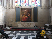
On this warm sunny Saturday our destination was Cambridge. As you can see by Alexander's expression the kids were 'thrilled' to be spending Saturday in Cambridge. To get them to go peacefully we had to promise that next weekend they could vegetate at home, doing absolutely nothing that could be construed as educational or of a physical nature such as walking. Another first for me - a ride in a double-decker bus. All around the city outskirts there are Park and Ride locations, where for £2 each, children are free, we were transported into the city centre on modern double-decker buses. My only experience with English bus travel was watching an old BBC TV program called On the Buses. Our first stop was King's College, one of King Henry the Sixth's two royal and religious foundations; the other being Eton College. King Henry VI laid the foundation stone for King's College on Passion Sunday 1441. Prior to our visit I researched Cambridge on the Internet and found one website that suggested, to tour areas of the Colleges closed to the public one should carry text books and have the air of a scholar - or produce a counterfeit students pass. We ignored these suggestions and were forced to keep to the paths designated for tourists. I have seen many chapels in the Cathedrals of England and attended many services in the Lady Chapel of St George's Cathedral in Kingston, Ontario, so I was unprepared for the size and grandeur of King's College Chapel. The absence of transepts and side chapels just enhanced the length and height of the interior. We were allowed to take photographs, but without a flash as it may set off alarms, so what photos I took lacked detail. The chapel is bisected by a large dark oak Screen that houses the organ. The screen was a gift from Henry VIII and bears the initials of both Henry VIII and those of his Queen, Anne Boleyn. This dates it between his marriage to Anne in 1533 and her execution in 1536. History before our eyes. The altar stood in front of ' the Adoration of the Magi', painted by Ruebans in 1634. This was gifted to the Chapel in 1961. Our next stop was St John's College. unfortunately we were restricted to the Chapel, Chapel Court, First Court and Second Court and again photos were allowed but without flashes. St John's College was refounded by Lady Margaret Beaufort in 1511. Previously it had been the Hospital of St John, a monastic order founded in the early part of the thirteenth century. From there we went back in time to a round church built in about 1130 by the 'fraternity of the Holy Sepulchre'. It is one of only four round churches built following the crusade of 1097. The construction of all four was influenced by the Church of the Holy Sepulchre in Jerusalem built by the Emperor Constantine in the 4th century. Initially it served as a wayfarers' chapel situated on the main road through Cambridge. In the 13th century it became a normal parish church with the addition of a chancel and north aisle. There were bikes everywhere! The one thing that does not show up in the photo of bikes leaning against a wall is the sign reading 'Please do not lean bikes against this wall' - students!!
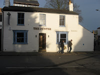
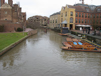
No visit is complete without a trip to a pub, but it was difficult to find a pub that had a table for four and allowed persons under 18. We set out with map in hand and crossed over the river Cam with its punters out and about and found the punter where we had some of the best french fries - I mean chips - yet and I had pint of Woodforde's Wherry; another fine example of a cask ale.
We made our way back to the bus stop for our green Park and Ride bus (they are colour coded, a great idea for someone like myself who has trouble remembering where I put my hat). On the way I snapped the photo of the building leaning out into the street. It seemed out of place with all the beautiful architecture of the colleges and churches, but I imagine this is an example of what many of the shops must have looked like in a bygone era.
Another wonderful day discovering England.
Thursday, 22 January 2009
Tuesday, 20 January 2009
19 January Geddington
Jeff works at a US Military base, RAF Molesworth, and had Monday off because of Martin Luther King Day. It was decided that this would be another caching day in and around Geddington. A fellow parishioner, Phil Rogers, suggested I should visit Geddington to see the Eleanor Cross, the best preserved of three remaining original crosses. Eleanor of Castille, wife of Edward I, also known as Long Shanks. He was in the process of trying to illegally invading the sovereign nation of Scotland. Eleanor was travelling to meet her husband in Scotland when she died at Harby, North Lincoln. Her body was taken back to London and entombed at Westminster Abbey. The King was so grief stricken he gave orders that every place where her bier had rested, a cross be erected in her memory.
It was raining when I first got up but by 10:30 the sun was out and we set off for our first cache. This one was titled Shockingly Easy Cache, and it was; unfortunately it was full of water. In this rather damp country I would have thought that anyone placing a cache would make sure it was in a waterproof container.
Our next stop was not a cache, it was Eleanor's Cross in Geddington. I was surprised at how well it had survived 700 years of exposure. I suspect that the lack of nearby heavy industry and carriageways has kept pollution to a minimum.
It was close to noon so we stopped for a pint and a meal at the Star Inn. Upon entering the establishment we were greeted with a "y'alright" instead of a 'hello, how are you', strange but to the point with fewer syllables.
I enjoyed another cask ale, Black Hole Brewery's Red Dwarf, another fine English Ale. Jeff had a pint of Scrumpy, a traditional Irish cask farm cider. I will have to try this cider at another time as one pint of ale was enough with more caching ahead of us in the afternoon: although, I must admit it was very tempting to spend more time by the fire. But, onward and upward!!
On the way to our next cache we made a detour to Lowick to view a church with a rather strange spire. At first glance I thought the spire was being used as a transmission site for radio, but on closer inspection we found the "antennas" were actually wind vanes. The church sat on a hill above the surrounding farms and on that day it was very easy to tell from which direction the wind was coming; it was blowing a small gale so all you had to do was watch in which direction your hat was blown off. We counted 12 smaller wind vanes with a large central vane pointing to the north.
The coordinates to the next cache took us to St Michael and All Angels Church in Wadenhoe. This was a rather frustrating cache because we were unable to locate the container. Both GPS receivers kept taking us to the same point on a stone wall but we were unable to locate the cache. We gave up after about 30 minutes of searching. Jeff later checked the cache log on the Geocaching website and found that the last person to find the cache did so by calling his friend, the person who placed the cache, and getting directions from him. Even with those directions it took him a few minutes to find the cache. Twenty-two people have found the cache so far and twenty-two people were unable to find the cache, so, thought frustrated, we didn't feel too bad about missing this cache.
Our next set of coordinates took us to a cache near Brigstock. This boosted our confidence as it was an easy find. The next cache was on down the road, but we found that the public road stopped and we were travelling on a lane way to a farm We soon found the lane blocked by a gate and it was a choice of parking and blocking the lane or parking in the farmer's yard. As neither option was viable we turned back and went on to the next cache.
The coordinates took us to a group of abandoned buildings. The logs of those who had found this cache earlier speculated that it may have been an abandoned air base from WWII. As soon as Jeff saw the water tower he was sure it was a military base. Many old bases were abandoned with the water tower left standing. We found the cache and rattled around the old buildings, finding rusted out logging equipment, hay storage and a huge supply of fertilizer spread among many buildings.
The next set of coordinates were nearby and took us to a memorial to the, and I quote from the memorial; In memory of the 351st Bomber Group (Heavy), Eighth United States Army Air Force. 311 group combat missions were flown from this airfield over occupied Europe between 1943 and 1945. 175 B-17 Flying Fortresses and their crews were lost, 303 enemy aircraft were destroyed in aerial combat.
The clue to the cache location was "check the eleventh tree from the memorial end." We had one major problem. There was a muggle (any person not involved with the hunt) in a truck parked near the memorial. I counted eleven trees and guided Jeff to move the car to place it between the tree and the muggle so he would not see what we were doing. After both of us looked at the tree we moved out to other trees with little success. Jeff returned to to the tree and found the small cache container hanging from a branch.
We decided to call it a day and head home. On the way I spotted an abandoned water tower and Jeff pulled in to show me another memorial to an airbase, the 457th Bombardment Group.
We arrived home to Alexander standing in the hallway with his hands on his hips telling us that we were late and he had been worried sick (I am pretty sure it was with tongue in cheek). After a quick cuff to the head to straighten him out we proceeded to make dinner.
Another fine day in the country side. I get as much enjoyment in seeing little, out of the way villages as I do visiting cathedrals.
Monday, 19 January 2009
18 January - The Greenman
After our little excursion of Monks Wood on Saturday we thought a roast beef dinner at the Greenman was an excellent outing for the day. The dinner, as always, was very delicious and very, very filling. Unfortunately I had my first mediocre cask ale, a Davensports Busy Man. It was a very light, very sweet ale that was not to my taste; ah well, I have to expect a few of those in my travels. After the carvery we checked out the self-serve eggs and vegetable stand across from the pub. Pick out what you want and pop the coins in a cup.
From there Jeff took us to St Swithin's church to see the graves of four Canadian airmen buried in the cemetery. If you go to this link, the four airmen are listed at the bottom of the page. The story is that these four airmen while on a training mission during WWII, struck the top of the steeple of St Swithin's church and died in the crash of their bomber. The steeple was replaced and the new addition can be seen as a light grey in the photo. The old top of the steeple is still on the grounds of the church.
Last year Canadian soldiers held a Remembrance Day service at the cemetery presided over by Jeff's mother Chris, a United Church Minister.
From there we made our way home via St Andrew's church, Wood Walton. The earliest part of the existing structure is the South Arcade which dates from the mid 13th century. The church was declared redundant and officially closed in 1972. Vandals all but destroyed the church in the following years. It was saved by the charity The Friends of Friendless Churches.
Another full day and by full I mean I ate too much at the Greenman and had to almost rolled into the house where I slowly recuperated enough to have some dinner.
Sunday, 18 January 2009
17 January Monks Wood
Saturday seemed like a good day to check out Monks Wood,an ancient wood a short drive from Abbots Ripton. Jeff had scouted out this area earlier as a possible site for up to 5 caches. He had spoken to the ranger in charge and had a tentative go ahead.
One of the things that I enjoy about geocaching is the discovery of new and interesting places. In Kingston, Ontario I discovered areas and sights in the city that I didn't know existed. In placing caches in Monks Wood, Jeff hopes to introduce the ancient wood to other geocachers.
Our aim was to find a few spots where Jeff could establish caches. This mainly involved finding a hollow tree or tree stump, taking a picture and entering the spot into the GPS receiver so we could find it again. Caches must be at least 100 metres apart so we saw a good deal of the wood. One other use of the GPS receiver is to record our journey as a track, which can be later viewed on a computer and compared to the map of the wood to see what areas we had travelled through. We found we had covered about half of the major trails in the wood.
Flora and fauna were almost non-existent, save for a few starlings and the odd squirrel.
The wood has resident populations of rabbit, hare and fox, but we saw none of these, although J.J. would frequently pick up the scent of something as we walked along.
"One of the biggest influences on the wood over the last 20 years has been the enormous increase in the numbers of deer. Muntjac deer are extremely common and cause great damage to flowering plants, shrubs and trees, especially saplings. Muntjac were introduced to Britain from Asia in the 1920’s, and have since spread over most of Southern England. They breed all the year round and have few natural predators. The deer are controlled by culling, and two large areas have also been fenced off to protect the vegetation from deer and to monitor their long-term impact on the wood."
We found a few deer stands along well defined pathways and Maeghan just had to try out her climbing skills.
We were able to find six possible sites for caches in about 1-1/2 hours of wandering. Jeff will present these to the ranger for approval and if all goes well we will return to place the caches.
All agreed it was a good day's outing.
Monday, 12 January 2009
10 January
Saturday morning found us on the road to a Geocaching Event on the north shore of the Thames Estuary, near Southend-on sea. A Geocaching event involves someone posting a notice on the Geocaching website that they will be hosting a gathering for all who wish to participate, usually at a place that has some significance, be it geographic, historical, or ecological. In this case it was at Hadleigh Country Park in a reconstruction of an Iron Age Round House. What also interested us was the longest Pleasure Pier (sounds naughty) in the world located at Southend-on-sea. So we set off early in the morning in a landscape entirely covered with hoar frost; all of the trees, even the tallest were covered with frost. It made for a surreal landscape.
We were on the road for less that an hour when we pulled off on a country lane for a quick grab of a cache at St. Giles church. This church had seen a lot of reconstruction, with the east end being mortar and rock decorated with flint nodules.
I have included Leigh Smith's reply to my query about the black rocks for those who are interested. For those who are not just skip the italics..
They formed when the tiny siliceous fossils that had been deposited in the calcium carbonate "soup" (sediment) of the Late Cretaceous were dissolved and then precipitated as quartz around small quartz silt grains in the sediment. Over time , this process formed the nodules we see today. (the very small amounts of organic matter that were present also collected there and, thus, the black colour typical of most "flints". Thus , flints in the chalks!
It is always fun to see if the local church in BBC Mystery TV stories has walls of flint. This guarantees that the featured village is situated on chalk!! Those medieval characters were not
into make-work projects! They used the local materials!
And once upon a time those chalk ridges were covered in flint nodules, from the differential dissolution of the calcium carbonate portion of the chalk. Now a days the ridges are just grass
covered , as those old guys had collected all the durable building materials long since!! (And those English types think grass is the natural state of those ridges!!! ) All the flints are gone and the trees that once were there have long since been cut down - for charcoal.
The west end of the church boasted a wooden spire supported by brick walls containing very old irregular bricks supported by 'S' shaped brackets and modern bricks.
Our next stop was Norsey Woods, a 165 acre woods with a 4000 year history. The hoar frost was still with us as we set out on a well-groomed path.
Our first cache brought us to a tumulus, a Bronze age burial mound, in which the cremated remains of two humans were found.
Our second cache took us deeper into the woods to a portion of the Deer Bank, a massive ditch and bank constructed by medieval land owners to to protect their wood, timber and hunting rights. The banks kept the deer in and the cattle out.
Our next stop was The Duke's Head where we had a very filling lunch in front of a coal fire. Once again Alexander had to settle for a hamburg without the French's Mustard he so loves. I was able to sample another fine real ale, Adnam's Southwold Bitter. So far all the ales I have sampled have been excellent.
After lunch it was on to Southend-on-sea to check into the Gleneagle's B&B and then see the sights. The kid's were jumping for joy when we found that there were carnival rides and ARCADES!!!; more legalized gambling for minors. Maeghan and Alexander had money to burn and the energy to try out every arcade in town, or so it seemed. Luckily there were pubs interspersed among the may arcades.
We had tried to take the train out to the end of the pier, but was told the pier was closed because it was too cold(?).
We made it an early evening as the next day was to be a busy one. Unfortunately only Jeff and I had a decent sleep; I kept Alexander awake with my snoring and J.J. kept Maeghan awake with his licking and pacing.
Sunrise the next morning was cool, crisp and clear. I took J.J. out for his morning ablutions and newspaper reading and shocked another guest, who was bundled up in a coat, scarf and hat. I was just in jeans and a T shirt and I heard him mumble 'must think it is spring, daft colonial' or something to that effect.
After a delicious breakfast (I was tempted to try a kipper) we set off to meet some other geocachers and do a multi-cache (find three caches that would give hints to the coordinates of the final cache) in the town before heading off to the event.
After a few wrong turns we found the Hadleigh Country Park and the reproduction of an Iron Age Round House. We checked in, said our hellos, picked up directions for the event caches and struck out into the park. We decided to do only a couple of the caches as the whole route was 5 kilometres long on muddy trails.
It was a warm, sunny day so we drove back to Southend, hoping that we would find the pier open. Sure enough it was and we took the train out to the end, 1.3 miles out into the Thames Estuary. The only building we found at the end was the Lifeguard Station; there were remnants of other buildings destroyed in the fire of 2005. I think the kids were hoping for some more arcades, but they were disappointed.
Jeff and I fired up our GPS units and we started back to the mainland, looking for a cache located somewhere about halfway along the pier. We located the shelter where the cache was hidden and it almost eluded us, but as we were leaving a last quick look by Jeff showed us the cache.
We ended our day on that positive note and headed home.
After we had finished our lunch on Saturday I loaded the coordinates for the Duke's Head into my GPS unit and it took us no time at all to find it on our way home. Jeff, Alexander and I opted for the roast beef dinner, while Maeghan, on a recommendation from Alexander opted for the hamburger (without the mustard). I wanted to sample another real ale but the other tap boasted a picture of Santa Clause and as I was unsure how much Elves knew about brewing beer I was prepared to have another Southwold Bitter. The bartender (is that the proper term over here?) pointed out that they had another Adnams ale - Broadside, so I tried a pint and it went down so well I had another.
With Maeghan plugged into her iPod and Alexander watching a movie we had a quiet drive home.
Monday, 5 January 2009
04 January
Jeff, Louise, Alexander and Maeghan have been to the farthest point west and farthest point south in the British Isles, so once we discovered there was a geocahe entitled Farthest Point East we just had to go after it. We set off early in the morning and after a 2 hour drive, in which I saw some new countryside while the kids (Maeghan, Rhiannon, and Alexander, with Jeff as referee) in the back watched a movie, we arrived in the village of Lowestoft. The first coordinates to the geocache brought us to a large compass rose on the breakwater. The outer circle of the the compass rose listed the distance to cities in England and Europe. By locating certain cities and their distances we were able to calculate the coordinates to the actual cache. After a short, very cold walk along the breakwater we found and signed the cache. We beat a hasty retreat to a pier to warm up and found an Arcade. Actually it was a form of legalized gambling for minors with many games of chance played with 2p coins. After warming up we headed out looking for a place to eat. We found the Thatch, located on the beach, and tucked into some excellent food. I tried the local Suffolk sausages with chips and peas. What is it with the English and their peas. Most entrees are offered with either a salad or peas (sometimes mushy peas), no carrots, no broccoli, no mixed vegetables, just peas. I mean, I like peas, but I also like variety. After lunch and a quick walk along the sand beach we headed off for our next cache. There we found eroding cliffs and the village of Covehithe, a village destroyed by the advancing North Sea. It was interesting to see the 'new' St Andrews (1672) built within the original St Andrews. As far as I can make out the old church was defaced by the Puritans around, but they did little structural damage. In 1672 permission was granted to erect a smaller church using materials from the large church. I would assume, once the roof was removed, the old church soon deteriorated. I was interested to see that the walls of the church are made up of fist-sized boulders and lots and lots of mortar. Some of the outside walls are decorated with shaped pieces of a black rock. I must remember to email Leigh Smith, a member of St George's and a professor of geology and ask him about the black rock. Part of the requirements of the cache was, give the rate of erosion, to estimate how long would it take for the cliffs to threaten the church. We estimated that in 75 years the church would cease to exist. Our next cache took us to the village of Southwold. We were directed to a pier, where, surprise, surprise, there was another arcade. We left the underage gamblers and went after the cache. We were directed to the middle of the pier to answer the following questions; 4 fillies visited - when ? 4 old nags returned - when ? and what were their names ? I went looking for the clock, a strange, water-powered sculpture, that performed on the hour and half-hour. Since I found it at 35 minutes after the hour, and as it was a cold, damp day, I decided to forgo the experience. I wandered on down to the end of the pier and found some dedicated fishermen trying their luck. One couple was sheltered behind a huge umbrella and the other has a free-standing tent. I thought this was a bit much until I remembered the hardy souls in Canada that venture out onto the frozen lakes to sit and stare at a hole in the ice for hours at a time. At least here they had more to see and a cafe nearby to grab a hot cuppa. Jeff and Louise solved the riddle by finding a plaque on the railing that gave the answers to the questions posed by the cache. The top of the railings on both side of the pier are covered with memorial plaques of visitors to the South Pier. I am assuming that the placement of theses plaques was a way of funding the upkeep of the pier.
Our next cache took us to the town of Aldeburgh, and onto a Ness (Over the last 10,000 years the sea levels off the Suffolk coast have started to rise by an estimated 2mm a year. This changing relationship between land and sea has meant that the coastline is being constantly altered. One geological change is the accumulation of shingle banks along the coast. These banks are known locally as Nesses. There are many of these in East Anglia - others local nesses can be found at Benacre, Kessingland, Languard Point and Thorpness. Originally the mouth of the river Alde was at Aldeburgh. However as the shingle bank has grown, the river has been diverted to the South, causing it to run parallel to the sea. In the 16th century the river mouth was at Orford but now the river finally reaches the sea at Hollesley Bay, 16km from its original outlet. This makes Orford Ness the largest vegetated shingle spit in Europe.)
On the Ness we found an "inhabited" Martello tower. Jeff did some investigating when we arrived home and found that the Martello tower was part of the Landmark Trust and could be rented for the weekend. I ordered the Landmark Trust handbook which lists many properties in England and Scotland that can be rented by the general public. We may be able to spend a weekend in a lighthouse, bunker or castle!
We also found some more avid fishermen on the Ness, all dressed in their North Sea survival suits. We left them to their fun(?), called it a well-spent, interesting day and headed home.
Subscribe to:
Posts (Atom)